| REQUIREMENTS |
| Permission |
Operation Administrator or higher |
| Connectivity |
Online only |
This document describes how to edit locations in the location catalog of your operation.
Background
The ability to edit locations and delete obsolete location from your from the location tree of an operation should allow users to main a clean catalog of relevant location at all time. However, please note that the editing locations affects all observations that have ever been associated with the given location. For example, if you change the location of a weather site, all associated historic observations will be moved to the new location. Similarly, when you change the name of a ski run, all of the associate historic avalanche observation will then be associated with the new name of the ski run.
We recommend the following guidelines for the maintenance of your location catalog:
- Editing is appropriate for minor changes in the attributes (e.g., fixing of typos, name changes, minor adjustments of their geometries) of location that still represent the same piece of terrain. This approach will ensure that that time series (e.g., long-time observations at a weather site with a changing name) will be maintained.
- If the geometry of a location changes considerable, it would be better to delete the location and create a new location under the same name. This approach will ensure that all observations associated with this location are displayed at their appropriate locations.
Step-by-step description
| 1.
|
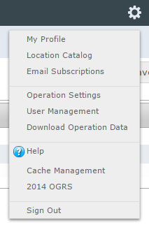
 Fig. 1: Administration menu for operation administrator |
| 2.
|
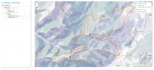
 Fig. 2: Location catalog screen
| ISSUE |
The system currently does not provide the user with any progress information about the loading of the location catalog.
JIRA: -834 (Aug. 26, 2013) |
|
| 3.
|
Expand the location hierarchy tree on the right as required by clicking on the little plus (+) signs left of locations that contain other locations.
| ISSUE |
The order of locations within the location tree is currently somewhat random, which make it difficult to navigate through large location trees. It is intended that the locations within each location parent would eventually be sorted by location type and name to make navigation easier.
Workaround: See Searching for a location in your location catalog.
JIRA: -832 (Sept. 22, 2013) |
|
| 4.
|
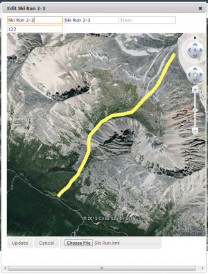
 Fig. 3: Location edit popup window
| ISSUE |
Sometime the menu options in the location tree do not seem to be enabled.
Workaround: Leave the location catalog page and return to it or completely restart the browser.
JIRA: -841 (Sept. 22, 2013) |
|
| 5.
|
Edit any of the information in the fields at the top of the pop-up window:
- Name (required): Full name of the location
- Abbreviation (required): Abbreviation to be used for the location in the tabular InfoEx reports.
- Description: Detailed description of the location
- External ID: The external ID of a location is required if your operation submits their observations from an external database system via the API (see How to submit observation to the InfoEx via the CAAML 3.0.3 API for more information). The external ID is also required for location that already existed in the legacy CAAML driven InfoEx and have historic observation associated with them.
- Elevation (weather site only): Elevation of weather site in meters.
| NOTE |
Since locations are primarily referred to by name in the InfoEx system, it is not advisable to create multiple location of the same type with the same name. However, the system currently does not explicitly check for it. |
|
| 6.
|
Add an appropriate geometry to the location. See Location types and symbology for details on the supported geometries for the different location types.
There are currently two options for adding geometries to a location:
| ISSUE |
Drawing directly in the Google Earth map has not been implemented yet
JIRA: -132 (Sept. 22, 2013)) |
|
| 7.
|
Click on Add to add the new location to the location tree of the operation. This will close the pop-up window and add the new location to the location tree.
| ISSUE |
Even though the information for the new location is committed to the system, the pop-up window does not always close.
Workaround: After clicking on Add, click on Cancel to close the window.
JIRA: -795 (Aug. 24, 2013) |
| ISSUE |
The main Google Earth map currently does not instantly update after any edits to the location catalog.
Workaround: To see the newly added location, exit the location catalog page of the application (e.g., go to reports) and come back to the location catalog page to refresh it.
JIRA: -831 (Sep. 22, 2013) |
|
|}
Related documents
- Link to relate document 1
- Link to relate document 2
Functionality tested by
- Oct. 21: Pascal Haegeli / QA Server / Test Version 0.31.00


