Difference between revisions of "Map view layer: Additional external information sources"
Jump to navigation
Jump to search
(→Layout) |
(→Layout) |
||
| Line 14: | Line 14: | ||
|style="vertical-align:top;width:150px;"|'''BC Drive Webcams''' | |style="vertical-align:top;width:150px;"|'''BC Drive Webcams''' | ||
|style="vertical-align:top;text-align:center;width:60px;"|[[File:ReportMapLayersARFI_DriveCams.png]] | |style="vertical-align:top;text-align:center;width:60px;"|[[File:ReportMapLayersARFI_DriveCams.png]] | ||
| − | | | + | |Access to the BC Highway Cams on Drive from DriveBC.ca. |
| + | * Click on the icon of a particular cam to to see its latest image. | ||
| + | * Click on the image to be redirected to DriveBC.ca. | ||
|- | |- | ||
|style="vertical-align:top;"|'''Snow Pillows''' | |style="vertical-align:top;"|'''Snow Pillows''' | ||
|style="vertical-align:top;;text-align:center;"|[[File:ReportMapLayersARFI_Snowpillow.png]] | |style="vertical-align:top;;text-align:center;"|[[File:ReportMapLayersARFI_Snowpillow.png]] | ||
| − | | | + | |Access to the automated snow pillow site of the River Forecast Centre of the BC Ministry of Forests, Lands and Natural Resource Operations. |
| + | * Click on the icon of a snow pillow site to see an up-to-date seasonal chart of water equivalent in the current snowpack. | ||
| + | * Click on the chart to be redirected to the River Forecast Centre. | ||
|- | |- | ||
|style="vertical-align:top;"|'''RWIS''' | |style="vertical-align:top;"|'''RWIS''' | ||
|style="vertical-align:top;text-align:center;"|[[File:ReportMapLayersARFI_RWIS.png]] | |style="vertical-align:top;text-align:center;"|[[File:ReportMapLayersARFI_RWIS.png]] | ||
| − | | | + | |Access to the RWIS disconnect data of the BC MoTI hosted at http://infoexwx.avalanche.ca |
| + | * Click on the icon of an RWIS station to get a link to the correct URL for viewing the data for the last 24 hours. | ||
| + | * Click on the provided link to view the data. | ||
| + | {{Note|The Java Applet used to display the information is not supported by Google Chrome on Macs.<br/>''Workaround'': Use a different browser to view this information. You can directly access the Applets from http://infoexwx.avalanche.ca/.}} | ||
|} | |} | ||
Revision as of 13:38, 2 January 2014
| REQUIREMENTS | |
| Permission | All users |
| Connectivity | Online only |
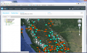
This document describes the functionality of the ARFI layer of the Map view of the InfoEx report.
The goal of the AFRI map layer is to provide users easy access to geospatial external information sources useful for avalanche forecasting purposes.
| NOTE | The name ARFI stands for Avalanche Research and Forecasting Interface and is from a Google Map project that Cora Shea developed for ASARC at the University of Calgary |
Layout
The ARFI layers currently support the following external information sources:
| BC Drive Webcams | Access to the BC Highway Cams on Drive from DriveBC.ca.
| |||
| Snow Pillows | Access to the automated snow pillow site of the River Forecast Centre of the BC Ministry of Forests, Lands and Natural Resource Operations.
| |||
| RWIS | Access to the RWIS disconnect data of the BC MoTI hosted at http://infoexwx.avalanche.ca
|
Functionality
- Click on the ARFI Layers label in the layer hierarchy panel to show/hide this layer on the map.
- Click on the label of an external information source in the layer hierarchy panel to directly zoom the map to the area that has related observation types.
- Click on the check box next to an external information source in the layer hierarchy panel to show/hide the particular external information source icons on the map.
Related documents
- Operation overview
- Avalanche observations
- Avalanche hazard
- Snow Profiles
- Field summary
- Weather observations
- Time slider (used for all map layers)
- Additional external information sources
Functionality tested by
- Jan. 2, 2014: Pascal Haegeli
