Map view layer: Field summary
Jump to navigation
Jump to search
| REQUIREMENTS | |
| Permission | All users |
| Connectivity | Online only |
This document describes the functionality of the Field summary layer of the Map view of the InfoEx report.
The goal of the Field summary map layer is to provide users with a spatial overview of all the field summary observations submitted in the time period of the current report and give quick access to the individual field summary records.
Layout
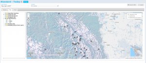
The field summary map layer shows the point locations of all the field summary observations included in the current report (Fig. 1).
Avalanches are shown at the following locations:
- At the centre point of the location(s) association with the observation.
The numbers around the field summary icons can be toggled on and off using the checkboxes in the layer hierarchy panel and represent:
- HN24 (south-west of icon, on by default)
- HS (south-east of icon)
- HST (north of icon)
Functionality
- Click on the Field summary checkbox in the layer hierarchy panel to show/hide this layer on the map.
- Click on the check box next to HS, HN24 and HST in the layer hierarchy panel to show/hide the measurements from appearing around the field summary icons.
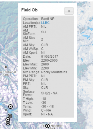
- Click on the icon of an individual field summary to view its complete record in a pop-up window (Fig. 2). The pop-up window contains all of the information that was submitted for the observation including links to any associated attachments.
| NOTE | If more than one of HS, HN24 and HST are selected to be on then multiple copies of the same pop-up window will be created so if you wish to view the pop-up windows it is recommended to select only one checkbox. |
Related documents
- Operation overview
- Avalanche observations
- Avalanche hazard
- Snow Profiles
- Field summary
- Weather observations
- Time slider (used for all map layers)
- Additional external information sources
Functionality tested by
- Jan. 2, 2014: Pascal Haegeli

