Difference between revisions of "Snowpack observations"
(→All supported fields) |
|||
| Line 38: | Line 38: | ||
| | | | ||
|} | |} | ||
| + | |||
| + | {{Note|The aspect-elevation rose diagram user control for entering general aspect and elevation information for the snowpack observations has not been implemented yet.}} | ||
==Special functionality== | ==Special functionality== | ||
Revision as of 12:39, 3 January 2014
| REQUIREMENTS | |
| Permission | All users |
| Connectivity | Online and offline |
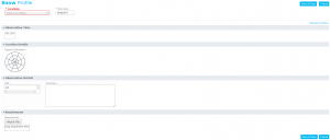
This observation type refers to snowpack observations as described in OGRS section 2. While the current version of the InfoEx application does not have explicit entry forms for snow profile observations like in SnowPro or other snow profile applications, the comments field of the snowpack observation type allows users to describe the main characteristics observed in their snow profile and their test results in free-text format.
| NOTE | The old InfoEx had an observation type call Snowpack Structure that was used for both the general description of the local snowpack structure and the description of snow profile observations. In the new InfoEx, these two observation types are separated more clearly. While snow profile observations are entered into the snowpack observation type, general descriptions of the snowpack structure are entered into the snowpack workflow module. |
Mandatory fields
Mandatory field are highlighted with a red outline and label. Incorrectly completed mandatory field will result in a validation error on submission.
| NOTE | If you cannot see the highlighted field in the favourite section of your observation entry form, open all of the sections at the bottom to find the field that is causing the issue. |
| Name | Mandatory | Comment |
| Location | Always | Location of observation; needs to be a single locations of any type. |
| Date | Always | Date of observation |
All supported fields
| Name | Mandatory | Comment |
| To be completed |
| NOTE | The aspect-elevation rose diagram user control for entering general aspect and elevation information for the snowpack observations has not been implemented yet. |
Special functionality
In addition to associating snowpack observations with a predefined location from your location catalog, it is also possible to drop a pin on a Google Earth map to indicate exactly where the observation was taken. See Providing the exact location of an avalanche or snowpack observation for more information on how to drop a pin.
| NOTE | The map layer for viewing snowpack observations in the map view of the InfoEx report has not been implemented yet. |
Related documents
- Difference between observations and assessments
- Weather observations
- Field summaries
- Avalanche observations
- Avalanche summaries
- Snow Profiles
- Terrain management
- General messages
- Avalanche control (additional subscription required)
- Customizing observation entry forms
Functionality tested by
- Jan. 2, 2014: Pascal Haegeli
